Garima Sharma, Pune
Satellite images shared by BlackSky, a US-based company, show underground bunkers built by China’s military in The People’s Liberation Army (PLA) base. The PLA is located near the northern shore of Pangong Lake in eastern Ladakh. This base was constructed in 2021-22. These bunkers are used to store weapons and fuel. Hardened shelters are also built, in a way that will protect vehicles during airstrikes.
An analyst from BlackSky told Hindustan Times on the condition of anonymity, “The current state of development at the base includes artillery and other defensive positions reinforced by large berms and connected by a wide-reaching network of roads and trenches that are not visible publicly available mapping applications.”
The shared image was taken on May 30 by a satellite that shows the eight sloppy entrances constructed to enter a large underground bunker. There are also five entrances to a smaller bunker near the larger one. The base is situated just over 120 km to the southeast of Galwan Valley, where a violent clash in June 2020 led to the loss of 20 Indian soldiers and at least four Chinese troops.
A former Indian Army commander told Hindustan Times on the condition of anonymity, “In today’s battlefield, everything can be pinpointed using satellites or aerial surveillance platforms. We have no such underground shelters on our side. Tunneling is the only way out to create better defenses.”
India’s infrastructure development has concentrated on enhancing living conditions by providing improved facilities to soldiers, as well as ensuring the safety of weapons and equipment in frontline regions. This increase in spending and quick implementation of key projects have driven the development of border infrastructure to assist military operations.
BlackSky with the help of its satellites can capture images 15 times in a day. BlackSky’s image shared on May 30 showed six J-20 jets parked next to eight Chengdu J-10 multi-role combat jets on the center apron. Also, earlier this year, satellite images from the Shigatse facility showed about six of China’s most modern stealth combat jets, the J-20s.
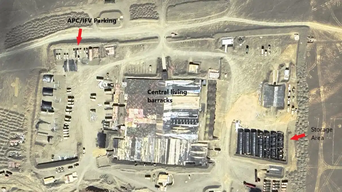
The satellite photos show China maintaining a complex road network on the Doklam Plateau that links military installations near the disputed boundary with India. A significant number of military vehicles were seen in an April satellite photograph at a forward position and rear base.